Excellent Hike to Machu Picchu – A Stunning World Wonder

Disclaimer: This blog contains affiliate links meaning I earn a small percentage of every purchase at no cost to you.

We had always planned to hike to Machu Picchu. This was what I wanted to do for my birthday. We didn’t book the Inca Trail in advance because we didn’t know exactly when we were going. Plus, it was too late to book as it fills up months in advance.

Finding the Salkantay hike was simple and now you can book in advance with an even better company. Some say it’s better than the Inca Trail as there are fewer people and it is much much cheaper. We were lucky as we booked it the day before in-person in Cusco. Overall, we paid US$200, you are paying for basic food and accommodation though. We didn’t mind this.

Day 1 – Machu Picchu: Mollepata and Challacancha

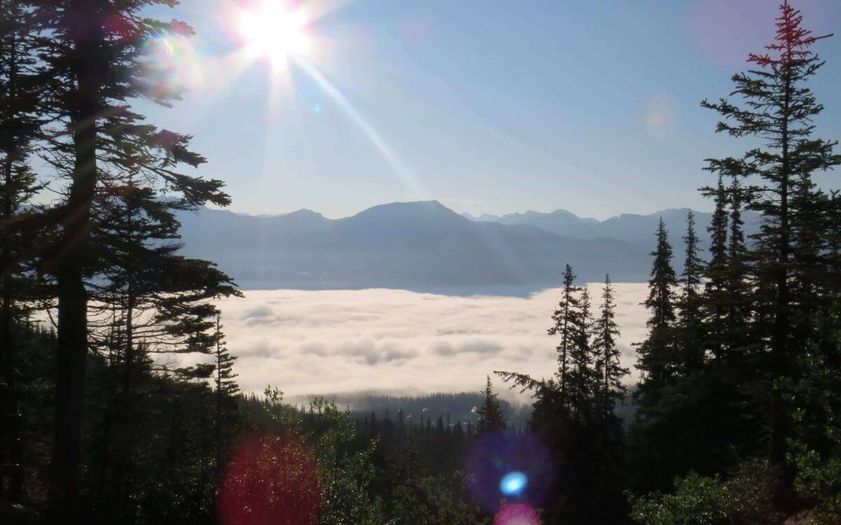
On the first day, we took a mini-bus to the starting point at Mollepata. We were roughly 2900 metres above sea level. This place provided us breakfast before setting off on the four-day hike. I’ll be honest here; I’ve never done more than a day of hiking in a row. I didn’t know what I was letting myself in for. Not only would we cover a lot of kilometres we were going to be at altitude. Something that is completely new to me too. We arrived in the main town of Cusco the day before we started hiking… let’s say this was our first rookie mistake.

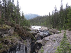
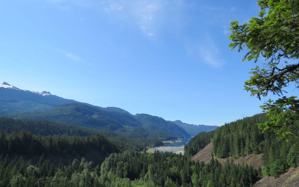
Anyway, we set following our guide uphill for the next 40 minutes. Then it was flat for the next 13 km to Challacancha (3600m). Not too bad, this was the camp for the night. However, I got bitten by a mosquito on the way to camp. This is pretty standard and I’m sure there would be more to come.

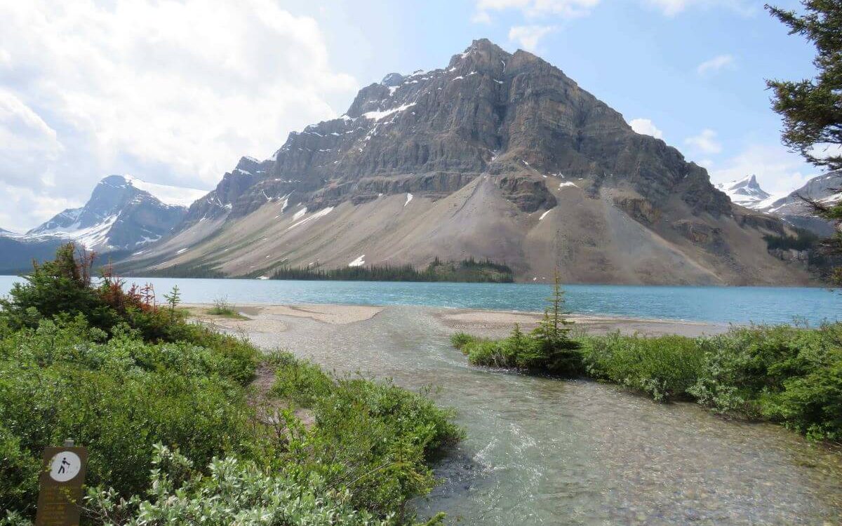
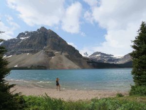
A Struggle to Lake Humantay

Lake Humantay on Salkantay Hike with clear water and snowy mountains
The Struggle to This Lake Was Real

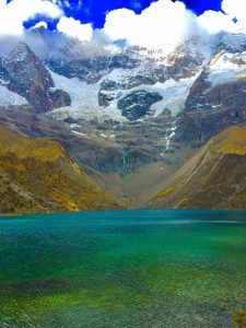
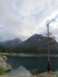
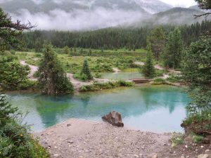
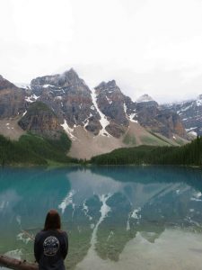
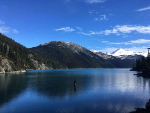
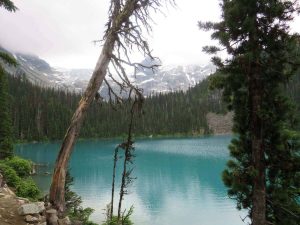
After a basic lunch, it was time to venture to Lake Humantay. A stop not on the Inca Trail and only on the Salkantay Trek. It was a further 400 metres up from camp. I have never struggled so much in my life… well, it certainly felt like I was going to die. I know extreme but I over-exaggerate.

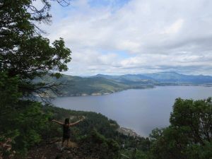
However, at the time it felt like this but I am not one to give up I kept on pushing through. Cheered on by one of the group members, I slowly made it. It was worth all the torture I had just suffered. The view was breathtaking, a crystal-clear lake with snow-capped mountains as the backdrop. Beautiful. This view was a first for me seeing this and it is well and truly edged into my memory for life. It’s moments like this that make the hard work worth it.

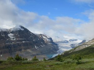
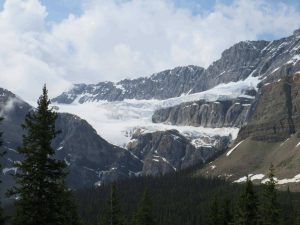
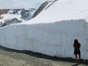
Day 2: A Hike up Salkantay Mountain

So, this day wasn’t our finest hour either. We hadn’t acclimatised to the high altitude before beginning this hike and now we started paying the price. The lack of oxygen was a struggle… we couldn’t hike this morning. Luckily there was an alternative… a horse. Something I have never been on and something my friend was allergic to. Yet, this was the option we had because of our first rookie mistake we were now making another.

You are probably wondering why this was our second rookie mistake… maybe it was the fact we were riding along the side of the mountain with a sheer drop on the edge or with horses that weren’t completely steady on their feet. The prospect of dying was high in our thoughts (again) however this time I feel it was justified.

Our mistake was riding the horses as these horses weren’t treated all that well. Unfortunately, I have seen worse. These were a healthy weight and made for this purpose. On the other hand, the luggage horses were driven up the mountain. This was not nice to witness as stones were thrown in their direction. I guess, people hike this section, therefore, this doesn’t get seen. It doesn’t make this right.

Heart Pumping Hard…

The top of Salkantay Mountain at 4,629 metres above sea level
The Snowy Top of Salkantay Mountain

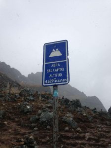
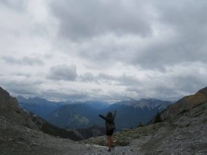
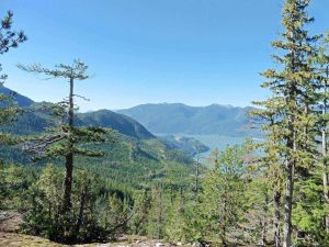
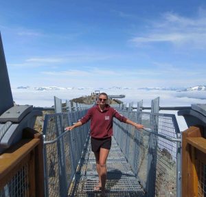
Once on the top of the mountain, I could relax, once again. The worst ride of my life was over. I let all the tension from that ride go. We were 4630 metres above sea level on top of the Salkantay Mountain. It was so magical as a few snowflakes fell. I love taking a moment and taking in my surroundings as nature is magnificent. After, back down we went moving slowly away from the cold.

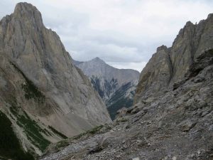
After lunch was another 15 km hike to the second and final camping night. This was physically tough as it felt like I was dragging my feet along. We didn’t even do the uphill part but yet this was still a struggle. It was up to my mental toughness to drag me through to camp. We did it. A long time after the others but still within the 3-hour guide time.

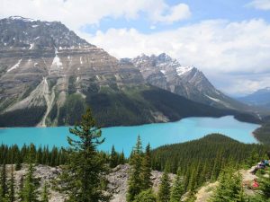
Day 3: A Day Hiking to Aguas Calientes

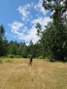
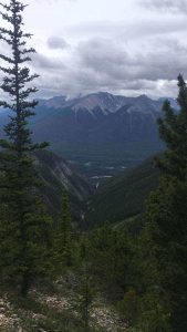
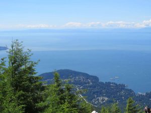
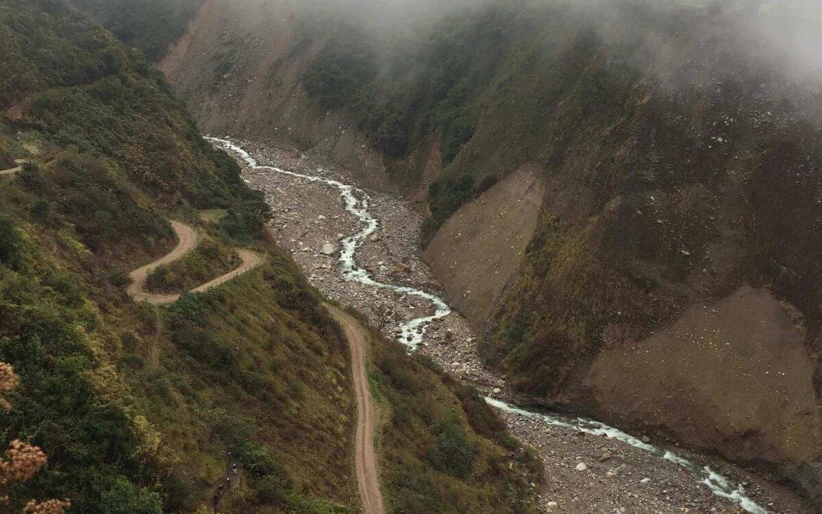
This was the lowest altitude we had been in so breathing was finally back to normal. We were only 1450 metres up. This morning’s hike was 16 km along what our guide told us was an Inca Flat. This meant steep up and downs followed by Peru Flat which was manageable ups and downs. This was through the jungle and the weather threw showers, sun, warmth, and cold at us; so undressing and dressing back up kept us entertained as we burnt through the kilometres.

We started walking in the wrong direction because our guide was so far in front, that he lost us. We went up the river bank instead of in line with the river. A guide over the river told us to turn around and take the other option. Phew… I didn’t fancy being lost somewhere in a Peruvian jungle. Although that would have been interesting.

The Peru Rail train to Machu Picchu going along the tracks
The Train That Nearly Hit Me

The last part of the hike was from Hidroelectrica to the town where Machu Picchu is (Aguas Calientes). This was a flat 2-3 hours walk. We took it at an unhurried pace. I would say to enjoy the last bit of the hike but it was due to sore, achy muscles. There wasn’t much to look at as it was along the train tracks. As exciting as this walk got was nearly getting hit by the train. We left as much clearance as possible. We thought we were far enough back from the tracks but the train is much wider than the tracks. Luckily, we made it to the Aguas Calientes in one piece… just.

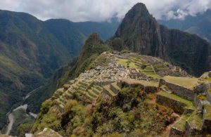
Day 4: Visiting the Ruins of Machu Picchu                                              

One view of Machu Picchu with low cloud
The Weather Failing Us At Machu Picchu

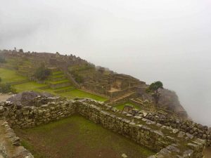
Waking up knowing that a day of hiking wasn’t on the agenda was gold. We set off earlier than the group to catch the bus (the cheaters’ way). But it had to be done because every muscle was sore. Once, in the grounds of Machu Picchu, the excitement was high as we explored yet another masterpiece. However, mother nature showed up too.

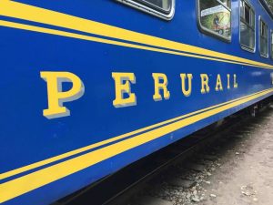
Yes, that’s right like most trips to Machu Picchu the early morning rains and clouds ruin the views. They lasted into the afternoon for us. We didn’t opt for the train back so another walk along the train line was in order. Finally, a waiting bus took us back to Cusco. I would recommend paying the extra for the train as you get longer at Machu Picchu.

The view of Machu Picchu from the top of the mountain
The View from The Top of Machu Picchu

Summary of the 4 Day Salkantay Hike to Machu Picchu

I have not sugar-coated how tough we found it from day 1 to day 4. Would I do it again? The answer is yes. Would I make changes? The answer is yes. We were very underprepared for the challenge that greeted us. Yet we still managed it. As tough as it was, I did enjoy pushing myself to extremes. And the sense of accomplishment when it was all over was unreal. I was so proud of myself. This means if we managed it, you can too!! It was so rewarding. The views, the different climates, changes in landscapes and Machu Picchu makes it well worthwhile.

P.S remember that mosquito bite on day 1… our third rookie mistake not taking anything to treat it with. It ended up bursting a couple of times meaning an infection got in. I was lucky that some over-the-counter antibiotics got rid of it. It could have been much worse.

Please go more prepared than us!!

Remember to check out my other South American adventures here!!

A Day Out on the Amazing Salt Spring Island

Disclaimer: This blog contains affiliate links meaning I earn a small percentage of every purchase at no cost to you.

Salt Spring Island is the largest island in the Southern Gulf Islands. You can access to Salt Spring Island by a ferry either from Vancouver Island or the Mainland. In my eyes, it is worth a day visit. The ferry leaves from Crofton on Vancouver Island and arrives at Vesuvius, Salt Spring Island. The journey only takes 25 minutes and a full day of exploring awaits. I would recommend having a car for this trip. There is a small bus route around the island but not very practical.

Salt Spring Island is famous for its Art Culture, organic farming, rugged coastlines, and natural beauty. There is plenty to explore on the island. We knew what we wanted to see and set off early. Also, starting early helps you to avoid hiking in the mid-day sun especially in the height of summertime. This is a must as it gets very hot.

A Morning Hike up the Magical Mount Erskine

The first point of call from the ferry was Mount Erskine. The trailhead was confusing to find. It does indeed have multiple entrances. The first entrance we arrived at looked like it was someone’s house (or so we thought). So, we did a bit more googling and found another starting point. We headed over to that one. This looked much better as there was a trailhead this time. I am not completely sure which trail we did, to be honest. We parked up at a turn-around area; I couldn’t tell you what road it was on.

Before setting off up Mount Erskine in search of what this trail offers, breakfast was on the menu. One of the best things about van life is you pick what view you have when you eat. This morning’s option didn’t disappoint.

Starting the Trail…

Fairy Doors at Salt Spring Island
The Only Fairy Door We Found

The trail started by entering a small clearing. As you enter you do get the feeling this is a magical place. The point of doing this trail is to find the fairy doors that lay throughout the forest. I had decided on wearing flip-flops. Therefore, to some people my choice of footwear is silly. I know it sounds silly but I feel like I have more grip.

We only found one fairy door on the hike and we didn’t quite make it to the top. It was a very unclear trail and people had made their own paths. At one point we ended up walking along a very narrow, steep, sheer drop cliff. Don’t get me wrong the sea view was amazing and worth it but this definitely got the heart racing. This was way more intense than the morning stroll I was expecting.

The View from Mount Erskine

Overall, this trail was a good hike. If you come, I would do some research on where the fairy doors as are they are hard to find. I believe there are many fairy doors so hopefully, you have better luck than us at finding them!!

Ruckle Provincial Park on Salt Spring Island

Ruckle Provincial Park is a coastal park that starts at Beaver Point on the South-Eastern shore of Salt Spring Island. The trail was a one-way 7 km hike to King’s Cove. In comparison, this was a nice relaxing walk compared to the climb up Mount Erskine. The trail was at sea level taking you through different landscapes. As well as an abundance of wildlife to look out for such as orcas, otters, and birdlife.

Dancing at Ruckle Provincial Park

Ruckle Provincial Park’s coastal path has amazing ocean views. The trail isn’t clearly marked either (seems to be the theme of the island). At times we went off course yet it was fun exploring the surroundings. There were times where we were hugging the coastline climbing over rocks. Most of the trail edged along rocky headlands, tiny coves, and bays to explore. Look out for rock pools. For us the tide was high so we didn’t see the colourful range of crabs and other species.

When away from the coastal path you work your way through the forest. Listen out for birds and watch out for turkeys and chickens. The Quartz Fields is the other landscape to view. Yes, we did dance around like idiots in the fields. No one else was around though.

A Relaxing re-charge at Beddis Beach

After all that hiking, we earnt this well-deserved afternoon at the beach. The beach was small but delightful. The beach we visited can be found at the end of Beddis Road. We parked on the side of the road, followed a path to the sand. Also, the beach was quiet which was surprising as the sun was out.

There were only about 5 other people on the beach. People were in the nude. There were no signs that we saw to indicate if it was a nudist beach. The water was a little cold but nice to wash off all the sweat!! We kicked back and topped up our tans in the mid-day sun.

Ganges Village

The Ganges Village is the largest village on Salt Spring Island found centrally on the east side of the island. The harbour was very busy and we watched many floatplanes come and go as we ate dinner.

Best Calamari on Salt Spring Island

Well, being by the sea only means one thing for dinner; fish n chips. We shared delicious buttermilk calamari which was very tasty. The main course of fish n chips that followed didn’t disappoint either. All of the food was cooked to perfection. Finally, a good choice for our treat. When I am on a road trip eating out is rare as I try and save my budget for adventures.

Summary of Salt Spring Island

There is so much to see and do here and the island definitely has a laid back feeling to it. Also, there weren’t many other tourists either so that was great. The few people we did meet on hikes were locals with great tips and knowledge. These hikes were very different from popular hikes like the Grouse Grind. This place is worth the visit if you want to escape the crowds.

A Road Trip in the Sensational Jasper National Park

Disclaimer: This blog contains affiliate links meaning I earn a small percentage of every purchase at no cost to you.

Jasper National Park is so beautiful just like Banff National Park. The Rocky Mountains have by far been the best views I’ve seen in Canada. Unfortunately, we only spent one day in Jasper as I was unwell and needed a cheaper doctor. We spent the day travelling up to Maligne Lake and back. I would definitely like to spend more time in Jasper National Park next visit.

To gain access to all national parks in Canada; you need a pass. Day tickets are around CAN$10 or you can purchase a year pass for around CAN$70. If you are visiting many national parks the years’ pass is more costive effective.

The Icefields Parkway Drive Through Jasper National Park

Icefields Parkway is the main highway through Jasper National Park. The Icefields Parkway runs for 230km from Lake Louise to the Town of Jasper. Driving it in both directions is a must. The views are breath-taking and some of the best you will ever see. Both directions are unreal.

Bow Glacier Falls Hike, Bow Lake

I was so excited to do this hike. We set off on this hike thinking it was 2km to the Bow Glacier Falls. The trail is in fact 8.7 km there and back. The trail is so pretty as it runs alongside Bow Lake. The hike takes you along the side of the river. Next, at a small clearing, the hike continues along the river bed. If you end up going up and through trees, you’ve missed the exit to the river bed. It is perfect weather not too hot or too cold for a change. A constant temperature so you weren’t always laying up and delaying. A refreshing change.

Me standing on the shore of Bow Lake in Jasper National Park
Bow Lake

I hike in flip-flops most of the time unless I know it’s going to be a long one. I find it comfier than trainers or hiking boots. We were on the hike for maybe an hour and a half then the worst thing happened. Unfortunately, flip-flops can be easy to break and yes that happened to me on this hike. Okay! Not quite the worst thing but it did put a stop to the hike. I tried to go on but it was all stones. Stones are my weak point and I cannot walk on them. So, we missed out on the Bow Glacier Falls. I felt gutted. If only I wore my trainers. Oh well, hindsight is a wonderful thing!

Viewing the Breath-taking Colour of Peyto Lake

The bright blue Peyto Lake in Jasper National Park
The Beautiful Peyto Lake

By the time we arrived at this lake, it was packed with tourists. However, that didn’t mean we could miss it as it is a must-see. It is a short 2.9 km hike to the viewing platform. This platform overlooks Peyto Lake. One word. Wow! The colour of Peyto Lake was incredible. You couldn’t even imagine it to be this good. I was still shocked even though I had seen many pictures of the lake. It is the rock flour that gives this glacier-fed lake its vibrant-blue colour. The colour simply pops and it will leave you speechless. Nothing compares to seeing this lake with your own eyes.

A Stop by Mistaya Canyon

Mistaya Canyon Jasper National Park
Mistaya Canyon

Mistaya Canyon was an early morning stop. After parking the car on a highway pullout, it is about a 5- 10 minute walk. The canyon is clearly signposted, so getting lost is impossible. As you walk along you can hear the river roaring past. After a short downhill walk, you reach the bridge. That is when all of a sudden the impressive slot canyon is insight. This canyon is truly a beautiful, natural wonder of nature.

The Hike Along Parker Ridge

Parker's Ridge Jasper National Park
The Valley on the Parker Ridge Hike

Parker Ridge hike was a simple 5km and after 2km you are hiking along the ridge. It wasn’t too strenuous. But I was ill so there was plenty of stopping along the way. The path zig-zags up the mountain before hiking along the steep ridge. It takes a small effort to climb the steep section at the start but after that, it’s all flat. However, you are then rewarded with great views of the Saskatchewan Glacier.

Athabasca Glacier and The Columbia Icefields

As the highway continues North you reach The Columbia Icefields section. The Columbia Icefields are the largest in North America covering around 325km squared and an average elevation of 3000m.

Crowfoot Glacier on Crowfoot Mountain

Crowfoot Glacier Jasper National Park
The Melting Crowfoot Glacier

The Crowfoot Glacier is visible from a lookout point on the side of the Icefields Parkway Highway. It is a glacier on the North-Eastern side of Crowfoot Mountain, overlooking Bow Lake. Simply put it’s shaped like a crow’s foot hence the name. However, it is melting therefore when we saw the crow’s foot, it had already lost a claw. The glacier water flows into the remarkable Bow River. This river runs from Bow Lake all the way to Calgary. Craving a remarkable flow of water through the valley.

Maligne Lake, Jasper National Park

Maligne Lake is 22km long and the second largest lake in the Canadian Rockies. The colour of the azure blue is unbelievable. Also, it looks very inviting for a swim but don’t be fooled, it is way too cold for that. Maligne Lake has an elevation of 1,670 metres above sea level.

Lake Maligne Jasper National Park
Lake Maligne in Summertime

Here we took the boat trip on offer at Maligne Lake. We were extremely lucky as we didn’t book in advance. I would highly recommend the boat ride as well as booking in advance. The boat ride isn’t the only option to explore Spirit Island, you can also rent kayaks. However, I was too ill to do any more exercise. The Hike up Parker’s Ridge was enough for me.

Our tour guide was new to the job but this didn’t hinder the experience. She was awesome and provided us with all the facts as we travelled up to Spirit Island. The Canadians gifted our Queen (Great Britain) a mountain range for her birthday one year. The Queen Elizabeth Mountain Range sits on the shoreline of Maligne Lake. This mountain range as it’s shaped like a ‘J’ making it different from the standard linear-shaped ranges. Very unusual.

Travelling Back Down the Icefield Parkway Highway

So, we missed some stops on the way up. Yet, planned to hit them on the way back down. The joys of travelling the road both ways. I highly recommend doing the drive in both directions. You get very different views but all equally as beautiful and breathtaking. You can stop at the highlights in any order you would like. The joys of road tripping.

Athabasca Falls, Jasper National Park

Athabasca Falls sits at 23 metres, not the tallest waterfall within Jasper National Park. However, it is the most powerful due to the sheer volume of water that flows from the Athabasca River. Another mind-blowing canyon falls. Yet if you visit in the evening can witness an incredible alpenglow on the mountainous backdrop.

Sunwapta Falls, Jasper National Park

A short walk from the car, two waterfalls flow into the River Sunwapta. We didn’t do any of the hikes on offer as time was pressing on. The falls were great to view due to the gorgeous mountain backdrop and descend into a limestone gauze.

From the highway, you can see Kerkeslin Lick Goats. All you do is slow the car down and witness the mountain goat licking the salty minerals left behind. These are about 15 minutes North of Sunwapta Falls.

Tangle Creek Falls

This is a little waterfall on the side of the Icefields Parkway. Delicate multi-tiered waterfall on a cliff face. You can view it straight from your car as it is on the side of the road. Yet, it was nice to get out and stretch my legs. I had already done so much driving and had plenty more to do.

Big Bend Viewpoint

You can’t miss it, it is quite literally a big bend when you come back South from Jasper. We pulled in here to enjoy the view but I noticed that my car felt cold. I lifted the bonnet of the car to find that the oil cap had come off. However, it didn’t dampen my spirits because the view was incredible.

At this point, there is no cell phone service. Therefore, we kept going until we got to the motel at Saskatchewan Crossing. It all worked out in the end. We called BCAA and got a tow truck instead of risking the car. It was a welcome relief not to drive the last 200 km to Canmore. We made it safely to Canmore where we went straight to sleep.

Summary of Jasper National Park

Overall, the national park didn’t disappoint in any way. It was amazing just like Banff National Park. It was all breathtaking and I love nature so I felt right at home exploring the trails. I wish we had more time to really explore Jasper on longer hikes but I needed rest and a doctor. Jasper National Park is worth the visit even if you only have a day like us.

Beautiful Banff National Park – What is There to See?

Disclaimer: This blog contains affiliate links meaning I earn a small percentage of every purchase at no cost to you.

The Canadian Rockies is the most famous landmark in Canada. Also, they are what most people come to Canada to see. I can understand why. This was simply nature, at its best. Personally, I love nature and there was just so much to see here in Banff National Park. Again, we are road tripping so, therefore, visiting places at our own pace. I highly recommend hiring a car as it is the easiest way to see everything.

Highway 1A – A Scenic Drive Through Banff National Park

There is the quick and main highway 1 that runs through Banff National Park. However, the best option for tourists is to take the more scenic Highway 1A. Highway 1A is also known as Bow Valley Parkway. The chances are higher to spot bears and wildlife. Remember to stay far away as possible and do not feed wild animals.

Lake Minnewanka, Banff National Park
Lake Minnewanka

Lake Minnewanka – A Glacier Fed Lake in Banff National Park

Arriving at Lake Minnewanka early in the morning was very pleasant. The sound of nature ringing out rather than the hustle and bustle of the tourists. Lake Minnewanka is a short 5 km drive from the town of Banff. This lake is impressive in size as it stretches over 21 km. Signs signalled that there was a bear active in the area. This meant that you are advised to travel in a group of 4. Unfortunately, we were a pair, therefore, no early morning hike for us. Plus, we left the bear spray in the van (again).

Lower Falls At Johnstone Canyon
Lower Falls

Johnstone Canyon and The Ink Pots – A Banff National Park Hike

To beat the tourists, it is best to go to all places early morning. Banff National Park is the reason why people come to Canada. Therefore, you can only imagine how busy this place gets. Our early morning hike to Johnstone Canyon only had a couple of other people. This meant no queue for the Instagram shot.

Hole View of Johnstone Falls, Banff National Park
The Hole Viewpoint
Ink Pots at Johnstone Falls, Banff National Park
The Ink Pots at Johnstone Canyon

1.2 km to the lower falls and an extra 1.2 upper falls. This is where most people turn around and go back. We didn’t we continued further to get to the ink pots. The ink pots are a further 10.8 km from the trailhead. The ink pots are the water source for the falls. They are vibrant blue in colour, round in shape, and dotted all over the field. These are pretty and worth the extra trek. It had been raining the day before therefore after the paved trail it did become muddy and slippery in places. Be careful! We managed not to fall!! Result.

The Cory Pass – A 13 km Hike in Banff National Park

This hike was definitely my favourite for many reasons. It was 13km but very hard work. This is no easy hike especially for us as we aren’t experts. Although, we had more stamina than when we did the Grouse Grind. Yet, if this was our first hike of the trip… I wouldn’t have made it. Grouse Grind was easy compared to this.

The saying is the harder the work, the greater the rewards. This was no different. We hiked hard. The reward was what I think are the best views within Banff National Park. This trail starts at the Fireside Picnic area off Highway 1A.

The starting point of the hike

The total elevation for this hike was 1075 metres. The trail quickly gained 450 metres. This section was without a doubt the steepest. There were splendid views over the Bow River and Township of Banff. Wildflowers were surrounding the trail as it started to flatten, however, it was still up and down a bit.

After this section, we reached the rocky path which took us uphill again. This was the start of the second hardest section of the hike. It looked like the trail ended at a bottom of a rock. Yet, the only way was over, we had to scale the rock. We climbed over safely and started to hike along the rocky path.

The View From the Cory Pass Hike
The View A Little Way Up on The Cory Pass

Taking in the 360 views

We took regular stops not just because we needed them; because you just have to take the time to appreciate the view.  There were spectacular views in every direction and the landscape changed so much in a short amount of time. You will not be disappointed. Nature is such a joy and Canada has so much of it.

Reaching the top of the Mountain

Top of The Cory Pass Hike, Banff National Park
The Hard Work Paid Off As We Reached The Top

At the top 2350 metres above sea level, it was cold and windy. Patches of snow left the resemblance of Winter. A gentle reminder of how cold Canadian Winter can be. The sense of accomplishment was through the roof, never would I have thought I would hike a steep mountain. A quick lunch break because the wind was strong and cold. Then, we headed around the back of the mountain on stone cairns which slipped from under us as we trod carefully. This was home to some Mountain Sheep. They have hooves designed to walk on these, we had runners on.

The Cory Pass, Banff National Park
The Hike Around The Back of The Mountain Range

Next, was a forest path and with the trees lining either side the views soon disappeared. We tried to pick up our pace as it looked like rain could fall any minute. Therefore, before we knew it, we were back at the fork where we turned left in the morning. This meant 1km to go till we were back at the car park.

The Last Surprise on the Cory Pass

This hike had already delivered so much but it had one last surprise for me. As I looked along the trail there it was a big brown fluffy behind. The only place I had seen this before was Grouse Mountain. I turned back to my friend to tell her and grab the bear spray. A WILD GRIZZLY.

Mountain Goat Hiding from The Grizzly Bear
We Didn’t Get a Snap of The Grizzly Bear so
Here’s a Mountain Sheep

In that thirty seconds, the Grizzly Bear made its way off the trail and up slightly. And all you could see was his head in amongst flowers. He was happy. He had a food source. And lucky for us hadn’t noticed us. This was unbelievable and topped off the hike perfectly. It was scary and exciting all at the same time. The adrenaline rush from completing a difficult hike and seeing an incredible Grizzly in its natural habit was mind-blowing. A must-hike in Banff National Park.

Lake Morriane – A Favourite

We visited Lake Morrianne in the evening expecting the crowds to be less. However, that was not the case. We managed to get a car parking space but only just. Luckily, someone was left as we arrived. A stroll along the shoreline to find the perfect dinner spot. Yes, dinner was glamorous tonight: ham rolls by the magnificent lake.

Lake Morriane, Banff National Park
Dinner at Lake Morriane

Lake Louise – Lake Anges to Big Beehive to Plain of 6 Glacier Hike

Sunrise Over Lake Louise, Banff National Park
What A Start To The Day A Beautiful Sunrise With Alpine-Glow

This day started with a magnificent sunrise over the most popular lake here in Banff, that’s right… Lake Louise. With snow still capping the Mountain Peaks that pink alpine glow was present as the sun rose. A treat to start the 20 km hike with. Firstly, we stopped by Lake Anges and the Teahouse. The teahouse served a good breakfast. Although it was very busy we were able to get seated straight away due to being one of the first there. So, it wasn’t long before we set off again.

Big Beehive Lookout

We slowly made our way up to the big beehive lookout. The route up was switchbacks that were steep! We made it in one piece, just with a lot of breaks. It was worth it; the wow factor was definitely here as I overlooked the incredible Lake Louise. The vibrant blue colour of this lake speaks for itself. A must-see.

Big Beehive Lookout Over Lake Louise
Big Beehive Lookout Point

Plain of 6 Glaciers

We made our way back down. It was downhill all the way. This was the moment the hike got tougher. Tougher because my sore legs had to carry me the rest of the way. Too many hikes in a short amount of time were affecting my body. I had to hobble down as my knee was too painful when doing the bending motion. This wasn’t the best situation but it wasn’t going to end my hike. Even though I had this small issue, I continued to the plain of six glaciers. This was relatively flat but still a further 4 km (roughly) there and back. Again, just like everything in Banff National Park the views were outstanding. Also, the sound of the ice breaking off the glaciers was ringing deep into the valley.

The Shoreline of Lake Louise

We could finally start to relax we were on the home straight. A nice stroll along Lake Louise shoreline. Sheltered in places away from the burning rays of the sun. The excitement and sense of accomplishment ran through us. I never thought I would ever hike over 20 km in one day but I did. I think I have found a new hobby… hiking. I am a fan; the hikes may be tough but the reward melts away all the moments that you think you can’t make it. Again, another must-hike in Banff National Park.

Summary of Banff National Park

Well, I am amazed and in awe, by all, I witnessed during my road trip through Banff National Park. I understand why the Canadian Rockies are the number one tourist attraction for people from all across the world. If the Canadian Rockies aren’t on the bucket list, add them, and you will be left speechless over and over again.

The Best Stops on Scenic Sea to Sky Highway

Disclaimer: This blog contains affiliate links meaning I earn a small percentage of every purchase at no cost to you

The sea-to-sky highway is one of the most beautiful scenic drives. I have stopped by many of the places along the Sea to Sky Highway. However, at different times during my time in Whistler. Driving up this road excites me as I know it is the way to Whistler. I spent the winter there in 2018-19 and it couldn’t feel more like home even if it tried. Starting at sea level and rising 670 metres above in the mountains. The smooth road has many twists and turns as you make your way up. If you are West in Canada then this drive is a must.

Sea to Sky – Cypress Mountain

Cypress Mountain is another Mountain in Vancouver. It was highly recommended to me by a family member so it was a must-stop. We got there early as we planned to hike to the top. Yes, I hiked in flip-flops and this time they didn’t break. My favourite flip-flops are

Effie's Lookout over Horseshoe Bay from the peak of Cypress Mountain
Effie’s Lookout. A Nice Lunch Spot in the Sun

We weren’t tired or experiencing achy legs at the top so decided to hike on to Effie’s Lookout. What a good decision that was. The views over the whole of the bay were incredible. To top it off the sun was shining and not many clouds in the sky. Another winning view for lunch. Lastly, we stopped by Cabin Lake for a quick dip, very cold. Jumping straight in was definitely a shock to the system!!

The Stawamus Provincial Park – Shannon Falls

Shannon Falls falling over rocks on the Sea to Sky Highway
Shannon Falls at Squamish

As you continue up the beautiful Sea to Sky corridor you reach Shannon Falls. This can be a quick stop if you don’t do any of the hikes on offer. Shannon Falls is the third highest waterfall standing at 335 metres. The waterfall wasn’t full yet but it was still impressive.

The Stawamus Chief, Squamish

Squamish Chief hike is very well-known with locals and tourists alike. So being a resident in Whistler it was only fitting to attempt to get to the top. I was scared to complete this hike. Rumour has it, that you have to climb a ladder for a bit of it. This is a very tough hike; luckily we weren’t in a rush so that we could take our time. Time was definitely needed to complete this.

The viewpoint from the chief hike over a forest and the Howe Sound
The View From Stawamus Chief

Stawamus Chief is 700m tall and divided into Frist Peak, Second Peak, and Third Peak. The trail starts at Shannon Falls.

The stairs at the start of the trial were the hardest part as well as coming back down. On the way back down I was trying not to slip and fall. We found ourselves scramming back down. As tough as this hike was, I am glad I conquered it. The views over the Howe Sound were amazing, it was a clear day so we could see well into the distance. If you are up for a challenge then this hike is for you!

Sea to Sky Gondola, Squamish

The view of a cove from the Sea to Sky Gondola
The View Coming Down the Sea to Sky Gondola

If you don’t fancy the hike up The Chief, you can always ride up in the Sea to Sky Gondola. You do need a ticket, unlike the hike. A quick ride up which takes you to a different viewpoint from the hike. There are many different trails to stroll along and the views of the snow-capped mountains made this perfect. 

Brandywine Falls, Whistler

Rainbow over Brandywine Falls in Whistler
The Rainbow Over The Falls

Brandywine Falls is a clean 70m drop into Brandywine Creek. This stop is a short one as it’s about a 15-minute walk from the car park. People just stop at the Falls but if you walk about 200m more you reach another viewpoint. If it’s a clear day you get an amazing view down into the valley.

The Cheakamus Train Wreck, Whistler

Two boxcars covered in graffiti at the train wreck in Cheakamus
Some of the Many Boxcars Left Behind

The train wreck dates back to 1956 when a speeding train raced through the valley, attempting the bend too fast. This crash left 7 train carriages in the forest at Cheakamus. These boxcars are along the Cheakamus River. Again, the first 5 are easy to find but walking further into the forest you will find the other two. It is well worth a stop.  

Cheap flights with cashback

Garibaldi Lake, Whistler, BC

Garibaldi Lake in Whistler with snow-capped mountains as the backdrop
The Impressive Garibaldi Lake

The Garibaldi Lake hike was an 18 km there and back hike. I was not ready for this in the slightest. I decided to go last minute with a hostel friend. The hike itself didn’t offer many views as I struggled uphill for 810 metres. This was my first lake experience in Canada. I was so happy. It didn’t disappoint and was bigger than any expectations I had. It was cold as Winter was drawing in. Yet that didn’t matter as I sat looking at the blue lake surrounded by snow-capped mountains. This is what I came to Canada for… well, snowboarding too.

Whistler and Blackcomb Mountain, Whistler

Me standing next to the snow walls on Whistler mountain
The Snow Wall on Whistler Mountain

What can I say about this small mountain town? I’ll be very biased as this place feels like home. I came for the Winter Season but I had to see this place in Summer too. Oh my, how a mountain can change so much between seasons.

Me at the starting point for the Whistler Suspension Bridge at Whistler Mountain
Conquering My Fear of Heights

The mountains (Whistler and Blackcomb) offer many hiking trails in the summer months. Whistler Mountain has a bike park for downhill riders. The suspension bridge tested my fear of heights. Viewing the snow walls was insane as you can see how deep the snow gets. That was amazing as I just spent the Winter snowboarding on it.

Over on Blackcomb, you can still make your way to 7th heaven and take in the breathtaking views on offer. Also, you can watch some glacier skiing/snowboarding.

It was well worth the summer day trip up the mountain.

Sea to Sky Highway – Nairn Falls

Narin Falls running through trees on the Sea to Sky Highway
Nairn Falls

Nairn Falls is a waterfall north of Whistler. It sits 60 metres high. The smallest of three the along the Sea to Sky Highway. It is a short 1.5 km to the viewpoint. Just because it was the smallest it doesn’t mean that you should avoid it. All three waterfalls are different types so stopping by all is a real treat.

Joffre Lakes, Highway 99

The excitement for this hike boiled over as I had waited so long to check out Joffre Lakes. I had only heard good things. 3 lakes to see and a total of 8 km there and back trip. The lower lake was only 5 minutes from the car park. The middle lake is around the 3.5 km mark. We set off, all uphill, and at quite a pace.

The emerald coloured middle lake at Joffre Lakes, a stop on the Sea to Sky Highway
The Middle Lake at Joffre

As we ascended the middle lake, we only had been hiking for 50 minutes. When we came across Middle Lake, I wasn’t expecting to see it just yet. I moved my gaze from the ground to head height. There it was. The crystal-clear blue glacier-fed lake. Also, the best out of the three, in my opinion. This was a ‘WOW’ moment. We hiked a further 20 minutes to Upper Lake, in this section you had to mind your footing. Scrambled over some rocks to find a spot for a snack. The view for this mealtime was impressive. Nature is simply the best in my eyes.

In conclusion, this highway was one of the best to drive with 360 views as you climb from sea level to ‘the sky’. This should be on your Canadian bucket list, for sure!! A real delight.