A Remarkable Week in the Stunning Galapagos Islands

Disclaimer: This blog contains affiliate links meaning I earn a small percentage of every purchase at no cost to you.

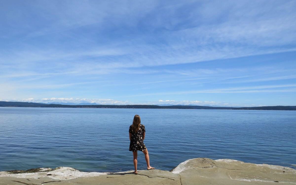
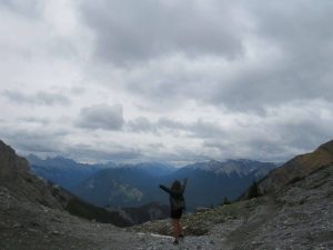
So as part of our South American trip for us, the Galapagos Islands couldn’t be missed. We saved extra money especially to experience the uniqueness of these Ecuadorian Islands. The excitement was definitely reaching fever pitch. A week in nature with wildlife unique to this area. A week of being in the sea and sand between my toes. I couldn’t be happier. I grew up by the sea and it is still my favourite place. Although, The Mountains now come a very close second.

Day 1 – Galapagos Islands: A Day Spent in Puerto Ayora on Santa Cruz Island

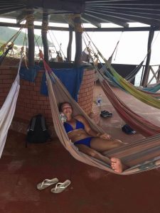
This is was our first full day on the island of Santa Cruz… apparently, October is the cool and dry time of the year with highs of 22 degrees. Well, being from England this still felt like summer to us. We opted for day tours to see areas as the cruises didn’t have any good last-minute deals. However, October is meant to be a good time for them. Your best bet to snag one of them is at the port by the airport not down in Santa Cruz. Or you can book a cruise in advance. These are on the pricey side but perfect if you are just taking a holiday.

A Visit to The Charles Darwin Centre on The Galapagos Islands

Our first adventure for the day was to the Charles Darwin Centre. The centre showcases all the conservation work going on to preserve the endangered species on the islands. Galapagos Giant Tortoise are impressive in size and can only be found here. These islands helped shape Darwin’s Theory of Natural Selection. And you can find all the information you need here at the Charles Darwin Centre.

Las Greitas swimming gauge in the Galapagos Islands
Las Greitas

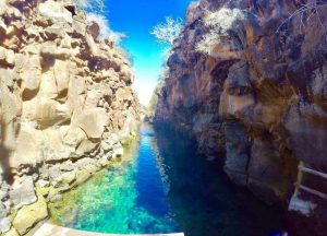
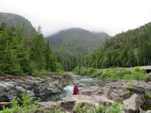
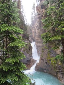
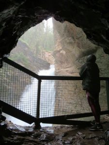
An Afternoon at the Las Grietas

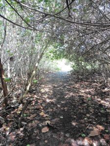
Las Grietas is an unknown adventure as it isn’t advertised. However, it is worth the visit. We were shockingly surprised this wasn’t spoken about more… maybe they were hoping to leave it as a local’s spot. An afternoon of fun. First, you catch the inexpensive water taxi across the water to the other side. Although, there is a little walking involved. It is simple enough as you follow the path. The walk is a little rocky but we did it in flip-flops with no problems.

Me and my friend jumping into the Las Grietas swimming area
Swimming in a Unique Place
A pink salt flat in the Galapagos Islands
Pink Salt Flat

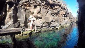
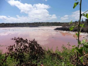
On the way to the final destination, we were surprised by a mini, pink salt flat. The walk is pretty with views back across the bay. We walked past the beach to the spot we were hoping to find. Las Grietas. This was an awesome unique swimming spot. It is a small channel of water between two volcanic rocks. Also, the water is turquoise in colour making it so inviting. Snorkeling is allowed and there is plenty of small fish to spot.

Day 2: A Day Boat Trip to Island Prizon

We were more than ready to be on that boat. Our first of three trips. It was a cool, windy overcast day as we set off from the dock with the tour group. We prayed that the sun came out. Along with the tour we were lent short wetsuits and snorkels.

The First Snorkel

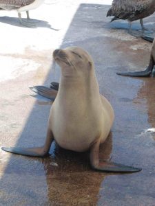
Our first snorkel of the day was around a shallow bay where sea lions were the entertainment. They are very playful. The visibility was good. We swam around. There was plenty of sea life such as many different varieties of fish, sea turtles, and stingrays. String-rays always give me a heart attack. I don’t like swimming near them. However, we were told these ones don’t sting. I’m not sure how true that is but I believed it at the time.

No one warned us how cold the sea was. I know we were there in October so a cooler month but it was worse than England’s sea temperature. In my eyes that is saying something. I go in the sea at home in the summer (England) in just a swimsuit. Crazy to think here the short wetsuit wasn’t enough to protect me from the freezing cold!!

A Walk Around Island Prizon

Sea Lion on Galapagos Islands
A Sea Lion Catching Some Sun

This stop was a short walk around the rocky coastline of the inhabited (well by humans) island. Island Prizon is in the middle of the sea. This island was home to the blue-footed booby. They actually get their name because they nest in the open. It was nesting season so we got to see it first-hand. Nests just lay there ready for predators to attack. Let’s hope they are good at defence.

The Second and Third Snorkel

Still freezing and no sun to warm us up yet; our guide was nice enough to combine the last two snorkels together. We opted out of the first half because around a rocky coastline to see green sea turtles. We had already seen many of them so getting warmer to enjoy the last part was our priority. With the sun breaking through we managed to warm up in time for the second part. Yes, I love it when a plan comes together. Of we jumped into the freezing sea again and caught up with the group.

This section was around a bay and the mammal we were looking for needed to be ticked off my list… White-tip Reef Sharks. Yes, that’s right… sharks. Sharks of the non-scary, non-human biting kind. I hovered still and quiet over about four or five of them. I didn’t finish counting before a member of the group who clearly lacked snorkel experience scared them all away!!

My friend who lacked speed in the water only because she was flipperless. A sore toe meant she couldn’t use them so she spent her time behind the group. This was a good thing because as she swam back to the boat. The sharks were swimming along with her. What a bonus.

728*90

Day 3: My First Ever Scuba Dive at Seymour

This nearly never happened. I went back and forth so many times. Yes, I can conquer this; actually, no I can’t. After a night of persuading me, my friend took me with her to the dive shop. Luckily, I was in luck they had a space on their beginner boat. The nerves really started to set in. I was quiet the whole boat ride out to the dive spot.

Finally, it was my turn. I don’t have a PADI so down with the instructor I went. I tried to go down once but failed. My goggles filled with water. I switched them out and down I went again. I had a session in the pool before coming but it wasn’t the same. Once under and distracted by all the awesome sea life I began to relax.

Sea lions kept me company for a couple of seconds rolling as they came past. However, the highlight was these small blue sea slugs pointing out from a rock. Only after, I discovered that these are a rare find. What a bonus to one of the most incredible experiences ever!!! I don’t know why I was so scared, to begin with. I definitely will do this again.

Day 4: Island Isabela, Galapagos Islands

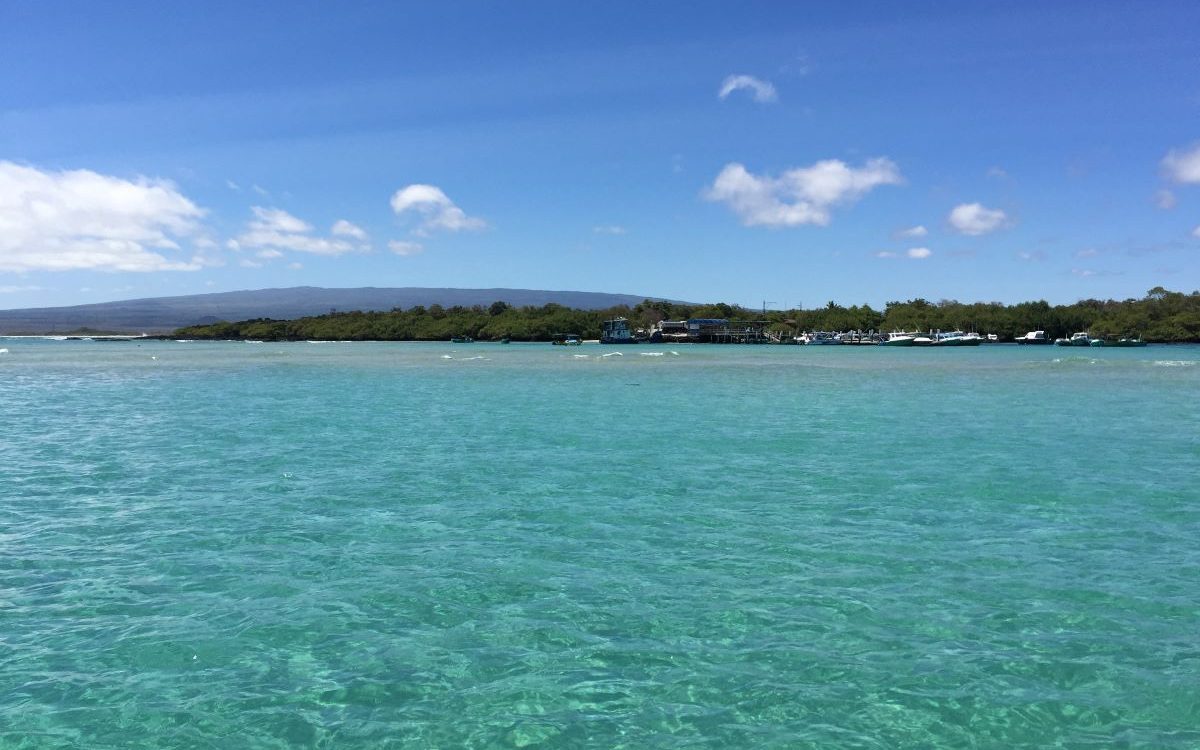
Another early start like our whole trip to be fair. There was once a time when you wouldn’t have me awake so early. However, as my days are filled with new adventures and new people waking up has never been easier. I was ready and raring to go. The ferry took us to Island Isabela, more of a local island, and much less touristy than Santa Cruz. After a smooth ferry over, we found accommodation and set off to explore.

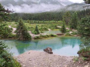
A Boardwalk Around the Mangroves

Mangrrove Boardwalk on Isabel
A Nice Walk Around Mangroves

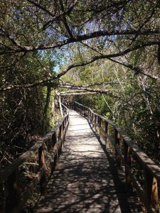
There is a nice stroll along a boardwalk that went through the mangroves and out to an open bay. Around this beach area, sea lions were high in numbers as well as marine iguanas. This is a reptile unique to just the Galapagos Islands. The marine iguana is the only lizard that forges at sea. This is incredible and a great showcase for adapting to the environment around you.

Afternoon Spent Walking Around Island Isabela

Sunset on Island Isabel
Fabulous Sunset

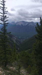
After a much-needed rest and refill, we were ready to set off and find the tortoise breeding centre. This turned out to be a much longer walk than expected but with different landscapes to keep us entertained. We found the Galapagos flamingo as we strolled around the wetlands. It was a long but easy walk as it was all flat.

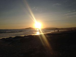
We made it back in time for sunset at the beach. I do love a good sunset and this one didn’t disappoint. Well, do sunsets ever!!

Day 5: A Boat Trip to the Lava Tunnels

This was our final full day here, and of course what else would we do? That’s right, we had another snorkel planned as this is a good way to see sea life. The lava tunnels are a popular choice and it only leaves from Island Isobel. Although, you can book it from Santa Cruz. This was the best one yet as luck was on our side. We were expecting penguins so when the guide told us we would be lucky if we saw one. We got a little disappointed.

As we headed to our destination, we were greeted with manta rays swimming past. They are so magnificent and graceful as they glide through the water. Also, there is something that only happens four times a year in the Galapagos Islands. A large pod of dolphins making its way through. Yes, that’s right we saw that too.

The lava tunnels were fun to snorkel around and as well as walk around. Again, this was a blue-footed boobie nesting site. The second snorkel was through quite shallow water so easy to tear up the sediment at the bottom. It did obstruct the visibility a little. Again, there was someone who couldn’t control the flippers… how annoying. Trying to get away from him and when we did.

The Amazing Wildlife…

The biggest string rays I have ever seen. I didn’t realise they could get so big. I’m talking way over 2 metres wide how impressive is that? I was nervous to swim over the top of them. As I started to swim over him he went on his merry way with such grace. Any ray swimming is incredible to witness as they make it look so effortless. Also, among this rocky bay lived some whit-tip reef sharks, again of an impressive size. Also, something I haven’t seen before… a collection of sea horses. This was fresh and exciting.

This was a day that kept on giving. From the moment we got onto the boat till the moment we docked. As we swam back to the boat this snorkel had one last surprise. Can you guess? The moment we had hoped would happen. The reason why we chose this day tour. Minding our business tired from the long snorkel suddenly the call out from our guide. There it was all alone resting at sea.

A PENGUIN!!!!!

Penguin in Galapagos Islands
The Best Moment of The Week

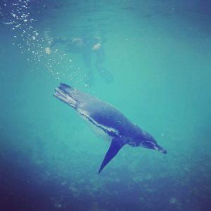
Just when we fought it was all over. The one animal we really wanted to see. Yes! This moment is so engrained into my memory I can picture it so clearly. We hovered in one place for what felt like ages and then suddenly the penguin dived down right in front of us. Undisturbed view of this incredible encounter. Words could not describe the happiness and excitement at that moment. WHAT A DAY!

Summary of the Best Week in the Galapagos Islands

Wow! This week left me speechless. Wildlife in its abundance. New experiences and many many vivid memories were made. This is one week I never will forget. I think you can guess what I am going to say. That’s right if you are in South America you have to make time and a budget for the Galapagos Islands. It felt like paradise every moment we were there. On every trip outside we encountered a variety of different species. What a magical week. A dream destination.

Driving Along The Attractive Highway 4 – Nanaimo to Tofino

Disclaimer: This blog contains affiliate links meaning I earn a small percentage of every purchase at no cost to you.

After getting the ferry from North Vancouver (Horseshoe Bay) to Nanaimo; we headed down to Tofino, a small surf town located on the West Coast of Vancouver Island. It is an easy drive, meaning you can’t get lost as you take Highway 4 all the way there. There are many beautiful stops along the way. So, take the whole day to do this drive instead of 3 hours. You will cover roughly 207 km.

Little Qualicum Falls Provincial Park – Nanaimo to Tofino

Little Qualicum Falls - Nanaimo to Tofino route
Lower Falls

This is the first stop on your way from Nanaimo to Tofino. Little Qualicum Provincial Park is about 9.3 km west of Highway 4. The trail loop is family-friendly. It has viewing points for both the lower and upper falls. These sit on either side of the Little Qualicum River. The waterfall was impressive and found by wandering through the plush forest. The crystal blue water was rapid and raged through the deep canyons. A perfect place to stretch the legs.

Nanaimo to Tofino – Cathedral Grove at MacMillan Provincial Park

Giant Red Cedar Tree on the way from Nanimo to Tofino
Me and a 800-year-old Cedar

After a short drive, you arrive at the next stop, Cathedral Grove. Cathedral Grove is home to the biggest and oldest Douglas Fir Trees and Giant Red Cedars. The trails are family-friendly and are on either side of the road. This place gets busy making it difficult to park. We arrived there around mid-morning and even that was a challenge. The parking is simply a pullover on either side of the highway. Please be aware of traffic and pedestrians especially in the summer months when crossing or driving.

Within this Provincial Park sits trees up to 800 years old. The sheer size of the Douglas Fir and Red Cedars are unbelievable and something you have to witness. The forest here is rich in different shades of green ranging from ferns, moss, and trees towering above. One of the short walks was less busy than the other. So as you strolled along the boardwalk you could hear birds chirping away. Peaceful.

Nanaimo to Tofino – A Hole in a Wall at Port Alberni

Hole in the Wall Nanaimo to Tofino
The Cool Random Hole in The Wall

The hole in the wall was our third stop as we travelled from Nanaimo to Tofino. The hole in the wall is a hidden unique stop as you enter Port Alberni. There is a dirt pull-out on the north side of the highway just before the Coombes Country Candy Store. Once parked up we crossed the highway on foot to find the hidden gravel pathway by the concrete barrier. Kind strangers have mounted small wooden signs to help you navigate the 15-minute walk to the hole in the wall.

The history goes that the locals blasted a hole for a water pipeline. Nowadays, it isn’t used and the water flows nicely over the rocks. When we were there wasn’t much water following. It now sits as a quirky photo opportunity and a peaceful stroll along the dirt path.

Wally Creek – Kennedy River Love Locks

After, we cooked our lunch at the port in Port Alberni. Also, we finished lunch just in time as the rain started to pour. We decided to continue the drive down towards Tofino. As we drove away, the mountainous rugged portion of the drive started. Following the incredible landscape for 56 km before coming to Wally Creek alongside the Kennedy River.

Wally Creek Nanaimo
The Magical Feel to Wally Creek

On a metal fence, people can leave locks for their loved ones unfortunately this wasn’t all that was left. RUBBISH or TRASH as some might call it. When adventuring and exploring these places we are entering nature, please pack out what you bring in. This fence hindered the experience.

In the other direction, away from the stupid ‘love locks’ fence, the views are amazing. Looking back up the river the views were the best we had seen on this journey. The Mountains were poking out from behind the misty backdrop. I couldn’t help but take it all for a while. The rain had stopped so the air was nice and cool. Carefully, we climbed over the rocks to get closer to the Kennedy River. Getting closer allowed us to get a sense of how powerful the water flow is.

Giant Red Cedar Trail

As we slowly edged closer to Tofino, the next stop was only 6 km from Wally Creek. Although hard to find it was worth it. Drive slowly and look for a small sign that signals the start of the trail. The dirt trail gives you a more intimate experience compared to the dug-out trail at Cathedral Grove. This particular forest lets you see the uniqueness of the Giant Red Cedars. Also, explore the river bank to take in more views of the Kennedy River.

The Forest Interpretive Trail

The pull-out for this stop is 1.5 km before the Pacific Rim Visitor Centre junction. So, if you hit the centre you have gone too far. This walk is different from the others as it educates you on the importance of rehabilitating the forests. If you are like me and love learning then this short walk is for you. As you maneuver your way along the boardwalk, you will see the importance of ensuring the health to restore old growth.

Wild Pacific Trail Ucluelet

Wild Pacific Trail
Taking The View In on The Wild Pacific Trail

We found a free spot to park for the night so that all could spend the day exploring Ucluelet (ukee… as locals call it). This is a small town located at the opposite end to Tofino in the Pacific Rim National Park. After filling up on a cooked breakfast at The Blue Room Cafe, we were ready for a day of hiking.

Wild Pacific Trail: Browns Beach to Rocky Bluffs

Wild Pacific Trail
The Rocky Coastline

Our first trail was from Browns Beach to Artists Loop (2.75 km) which cuts through a forest including oceanside vistas. The Rocky Bluffs is a 3 km return track along the coastline with incredible views. Also, this coastal hike includes a 1 km detour around the Ancients Cedar section. We spent the whole morning exploring all these trails. A good way to burn off the big breakfast.

Wild Pacific Trail: The Lighthouse Loop

Also, we did the 2.6 km loop known as the Lighthouse Loop. The trail starts at the 100-year-old Amphitheater Lighthouse before winding north along the rugged coastline. We completed this trail in the evening light. A perfect backdrop to watch the sun go down. To break up these two hikes we spent the afternoon visiting the beaches in Ucluelet. We topped our tans at Little Beach and Terrence Beach. Both nice and quiet.

Summary of the Scenic Pacific Rim Highway

This drive from Nanaimo to Tofino is something I highly recommend. Although lots of walking these stops were a welcome break from sitting behind the wheel. Again, this route is best if you have a car or hire one. As you can stop where you like, when you want, and forever for how long you wish.

A Road Trip in the Sensational Jasper National Park

Disclaimer: This blog contains affiliate links meaning I earn a small percentage of every purchase at no cost to you.

Jasper National Park is so beautiful just like Banff National Park. The Rocky Mountains have by far been the best views I’ve seen in Canada. Unfortunately, we only spent one day in Jasper as I was unwell and needed a cheaper doctor. We spent the day travelling up to Maligne Lake and back. I would definitely like to spend more time in Jasper National Park next visit.

To gain access to all national parks in Canada; you need a pass. Day tickets are around CAN$10 or you can purchase a year pass for around CAN$70. If you are visiting many national parks the years’ pass is more costive effective.

The Icefields Parkway Drive Through Jasper National Park

Icefields Parkway is the main highway through Jasper National Park. The Icefields Parkway runs for 230km from Lake Louise to the Town of Jasper. Driving it in both directions is a must. The views are breath-taking and some of the best you will ever see. Both directions are unreal.

Bow Glacier Falls Hike, Bow Lake

I was so excited to do this hike. We set off on this hike thinking it was 2km to the Bow Glacier Falls. The trail is in fact 8.7 km there and back. The trail is so pretty as it runs alongside Bow Lake. The hike takes you along the side of the river. Next, at a small clearing, the hike continues along the river bed. If you end up going up and through trees, you’ve missed the exit to the river bed. It is perfect weather not too hot or too cold for a change. A constant temperature so you weren’t always laying up and delaying. A refreshing change.

Me standing on the shore of Bow Lake in Jasper National Park
Bow Lake

I hike in flip-flops most of the time unless I know it’s going to be a long one. I find it comfier than trainers or hiking boots. We were on the hike for maybe an hour and a half then the worst thing happened. Unfortunately, flip-flops can be easy to break and yes that happened to me on this hike. Okay! Not quite the worst thing but it did put a stop to the hike. I tried to go on but it was all stones. Stones are my weak point and I cannot walk on them. So, we missed out on the Bow Glacier Falls. I felt gutted. If only I wore my trainers. Oh well, hindsight is a wonderful thing!

Viewing the Breath-taking Colour of Peyto Lake

The bright blue Peyto Lake in Jasper National Park
The Beautiful Peyto Lake

By the time we arrived at this lake, it was packed with tourists. However, that didn’t mean we could miss it as it is a must-see. It is a short 2.9 km hike to the viewing platform. This platform overlooks Peyto Lake. One word. Wow! The colour of Peyto Lake was incredible. You couldn’t even imagine it to be this good. I was still shocked even though I had seen many pictures of the lake. It is the rock flour that gives this glacier-fed lake its vibrant-blue colour. The colour simply pops and it will leave you speechless. Nothing compares to seeing this lake with your own eyes.

A Stop by Mistaya Canyon

Mistaya Canyon Jasper National Park
Mistaya Canyon

Mistaya Canyon was an early morning stop. After parking the car on a highway pullout, it is about a 5- 10 minute walk. The canyon is clearly signposted, so getting lost is impossible. As you walk along you can hear the river roaring past. After a short downhill walk, you reach the bridge. That is when all of a sudden the impressive slot canyon is insight. This canyon is truly a beautiful, natural wonder of nature.

The Hike Along Parker Ridge

Parker's Ridge Jasper National Park
The Valley on the Parker Ridge Hike

Parker Ridge hike was a simple 5km and after 2km you are hiking along the ridge. It wasn’t too strenuous. But I was ill so there was plenty of stopping along the way. The path zig-zags up the mountain before hiking along the steep ridge. It takes a small effort to climb the steep section at the start but after that, it’s all flat. However, you are then rewarded with great views of the Saskatchewan Glacier.

Athabasca Glacier and The Columbia Icefields

As the highway continues North you reach The Columbia Icefields section. The Columbia Icefields are the largest in North America covering around 325km squared and an average elevation of 3000m.

Crowfoot Glacier on Crowfoot Mountain

Crowfoot Glacier Jasper National Park
The Melting Crowfoot Glacier

The Crowfoot Glacier is visible from a lookout point on the side of the Icefields Parkway Highway. It is a glacier on the North-Eastern side of Crowfoot Mountain, overlooking Bow Lake. Simply put it’s shaped like a crow’s foot hence the name. However, it is melting therefore when we saw the crow’s foot, it had already lost a claw. The glacier water flows into the remarkable Bow River. This river runs from Bow Lake all the way to Calgary. Craving a remarkable flow of water through the valley.

Maligne Lake, Jasper National Park

Maligne Lake is 22km long and the second largest lake in the Canadian Rockies. The colour of the azure blue is unbelievable. Also, it looks very inviting for a swim but don’t be fooled, it is way too cold for that. Maligne Lake has an elevation of 1,670 metres above sea level.

Lake Maligne Jasper National Park
Lake Maligne in Summertime

Here we took the boat trip on offer at Maligne Lake. We were extremely lucky as we didn’t book in advance. I would highly recommend the boat ride as well as booking in advance. The boat ride isn’t the only option to explore Spirit Island, you can also rent kayaks. However, I was too ill to do any more exercise. The Hike up Parker’s Ridge was enough for me.

Our tour guide was new to the job but this didn’t hinder the experience. She was awesome and provided us with all the facts as we travelled up to Spirit Island. The Canadians gifted our Queen (Great Britain) a mountain range for her birthday one year. The Queen Elizabeth Mountain Range sits on the shoreline of Maligne Lake. This mountain range as it’s shaped like a ‘J’ making it different from the standard linear-shaped ranges. Very unusual.

Travelling Back Down the Icefield Parkway Highway

So, we missed some stops on the way up. Yet, planned to hit them on the way back down. The joys of travelling the road both ways. I highly recommend doing the drive in both directions. You get very different views but all equally as beautiful and breathtaking. You can stop at the highlights in any order you would like. The joys of road tripping.

Athabasca Falls, Jasper National Park

Athabasca Falls sits at 23 metres, not the tallest waterfall within Jasper National Park. However, it is the most powerful due to the sheer volume of water that flows from the Athabasca River. Another mind-blowing canyon falls. Yet if you visit in the evening can witness an incredible alpenglow on the mountainous backdrop.

Sunwapta Falls, Jasper National Park

A short walk from the car, two waterfalls flow into the River Sunwapta. We didn’t do any of the hikes on offer as time was pressing on. The falls were great to view due to the gorgeous mountain backdrop and descend into a limestone gauze.

From the highway, you can see Kerkeslin Lick Goats. All you do is slow the car down and witness the mountain goat licking the salty minerals left behind. These are about 15 minutes North of Sunwapta Falls.

Tangle Creek Falls

This is a little waterfall on the side of the Icefields Parkway. Delicate multi-tiered waterfall on a cliff face. You can view it straight from your car as it is on the side of the road. Yet, it was nice to get out and stretch my legs. I had already done so much driving and had plenty more to do.

Big Bend Viewpoint

You can’t miss it, it is quite literally a big bend when you come back South from Jasper. We pulled in here to enjoy the view but I noticed that my car felt cold. I lifted the bonnet of the car to find that the oil cap had come off. However, it didn’t dampen my spirits because the view was incredible.

At this point, there is no cell phone service. Therefore, we kept going until we got to the motel at Saskatchewan Crossing. It all worked out in the end. We called BCAA and got a tow truck instead of risking the car. It was a welcome relief not to drive the last 200 km to Canmore. We made it safely to Canmore where we went straight to sleep.

Summary of Jasper National Park

Overall, the national park didn’t disappoint in any way. It was amazing just like Banff National Park. It was all breathtaking and I love nature so I felt right at home exploring the trails. I wish we had more time to really explore Jasper on longer hikes but I needed rest and a doctor. Jasper National Park is worth the visit even if you only have a day like us.

Beautiful Banff National Park – What is There to See?

Disclaimer: This blog contains affiliate links meaning I earn a small percentage of every purchase at no cost to you.

The Canadian Rockies is the most famous landmark in Canada. Also, they are what most people come to Canada to see. I can understand why. This was simply nature, at its best. Personally, I love nature and there was just so much to see here in Banff National Park. Again, we are road tripping so, therefore, visiting places at our own pace. I highly recommend hiring a car as it is the easiest way to see everything.

Highway 1A – A Scenic Drive Through Banff National Park

There is the quick and main highway 1 that runs through Banff National Park. However, the best option for tourists is to take the more scenic Highway 1A. Highway 1A is also known as Bow Valley Parkway. The chances are higher to spot bears and wildlife. Remember to stay far away as possible and do not feed wild animals.

Lake Minnewanka, Banff National Park
Lake Minnewanka

Lake Minnewanka – A Glacier Fed Lake in Banff National Park

Arriving at Lake Minnewanka early in the morning was very pleasant. The sound of nature ringing out rather than the hustle and bustle of the tourists. Lake Minnewanka is a short 5 km drive from the town of Banff. This lake is impressive in size as it stretches over 21 km. Signs signalled that there was a bear active in the area. This meant that you are advised to travel in a group of 4. Unfortunately, we were a pair, therefore, no early morning hike for us. Plus, we left the bear spray in the van (again).

Lower Falls At Johnstone Canyon
Lower Falls

Johnstone Canyon and The Ink Pots – A Banff National Park Hike

To beat the tourists, it is best to go to all places early morning. Banff National Park is the reason why people come to Canada. Therefore, you can only imagine how busy this place gets. Our early morning hike to Johnstone Canyon only had a couple of other people. This meant no queue for the Instagram shot.

Hole View of Johnstone Falls, Banff National Park
The Hole Viewpoint
Ink Pots at Johnstone Falls, Banff National Park
The Ink Pots at Johnstone Canyon

1.2 km to the lower falls and an extra 1.2 upper falls. This is where most people turn around and go back. We didn’t we continued further to get to the ink pots. The ink pots are a further 10.8 km from the trailhead. The ink pots are the water source for the falls. They are vibrant blue in colour, round in shape, and dotted all over the field. These are pretty and worth the extra trek. It had been raining the day before therefore after the paved trail it did become muddy and slippery in places. Be careful! We managed not to fall!! Result.

The Cory Pass – A 13 km Hike in Banff National Park

This hike was definitely my favourite for many reasons. It was 13km but very hard work. This is no easy hike especially for us as we aren’t experts. Although, we had more stamina than when we did the Grouse Grind. Yet, if this was our first hike of the trip… I wouldn’t have made it. Grouse Grind was easy compared to this.

The saying is the harder the work, the greater the rewards. This was no different. We hiked hard. The reward was what I think are the best views within Banff National Park. This trail starts at the Fireside Picnic area off Highway 1A.

The starting point of the hike

The total elevation for this hike was 1075 metres. The trail quickly gained 450 metres. This section was without a doubt the steepest. There were splendid views over the Bow River and Township of Banff. Wildflowers were surrounding the trail as it started to flatten, however, it was still up and down a bit.

After this section, we reached the rocky path which took us uphill again. This was the start of the second hardest section of the hike. It looked like the trail ended at a bottom of a rock. Yet, the only way was over, we had to scale the rock. We climbed over safely and started to hike along the rocky path.

The View From the Cory Pass Hike
The View A Little Way Up on The Cory Pass

Taking in the 360 views

We took regular stops not just because we needed them; because you just have to take the time to appreciate the view.  There were spectacular views in every direction and the landscape changed so much in a short amount of time. You will not be disappointed. Nature is such a joy and Canada has so much of it.

Reaching the top of the Mountain

Top of The Cory Pass Hike, Banff National Park
The Hard Work Paid Off As We Reached The Top

At the top 2350 metres above sea level, it was cold and windy. Patches of snow left the resemblance of Winter. A gentle reminder of how cold Canadian Winter can be. The sense of accomplishment was through the roof, never would I have thought I would hike a steep mountain. A quick lunch break because the wind was strong and cold. Then, we headed around the back of the mountain on stone cairns which slipped from under us as we trod carefully. This was home to some Mountain Sheep. They have hooves designed to walk on these, we had runners on.

The Cory Pass, Banff National Park
The Hike Around The Back of The Mountain Range

Next, was a forest path and with the trees lining either side the views soon disappeared. We tried to pick up our pace as it looked like rain could fall any minute. Therefore, before we knew it, we were back at the fork where we turned left in the morning. This meant 1km to go till we were back at the car park.

The Last Surprise on the Cory Pass

This hike had already delivered so much but it had one last surprise for me. As I looked along the trail there it was a big brown fluffy behind. The only place I had seen this before was Grouse Mountain. I turned back to my friend to tell her and grab the bear spray. A WILD GRIZZLY.

Mountain Goat Hiding from The Grizzly Bear
We Didn’t Get a Snap of The Grizzly Bear so
Here’s a Mountain Sheep

In that thirty seconds, the Grizzly Bear made its way off the trail and up slightly. And all you could see was his head in amongst flowers. He was happy. He had a food source. And lucky for us hadn’t noticed us. This was unbelievable and topped off the hike perfectly. It was scary and exciting all at the same time. The adrenaline rush from completing a difficult hike and seeing an incredible Grizzly in its natural habit was mind-blowing. A must-hike in Banff National Park.

Lake Morriane – A Favourite

We visited Lake Morrianne in the evening expecting the crowds to be less. However, that was not the case. We managed to get a car parking space but only just. Luckily, someone was left as we arrived. A stroll along the shoreline to find the perfect dinner spot. Yes, dinner was glamorous tonight: ham rolls by the magnificent lake.

Lake Morriane, Banff National Park
Dinner at Lake Morriane

Lake Louise – Lake Anges to Big Beehive to Plain of 6 Glacier Hike

Sunrise Over Lake Louise, Banff National Park
What A Start To The Day A Beautiful Sunrise With Alpine-Glow

This day started with a magnificent sunrise over the most popular lake here in Banff, that’s right… Lake Louise. With snow still capping the Mountain Peaks that pink alpine glow was present as the sun rose. A treat to start the 20 km hike with. Firstly, we stopped by Lake Anges and the Teahouse. The teahouse served a good breakfast. Although it was very busy we were able to get seated straight away due to being one of the first there. So, it wasn’t long before we set off again.

Big Beehive Lookout

We slowly made our way up to the big beehive lookout. The route up was switchbacks that were steep! We made it in one piece, just with a lot of breaks. It was worth it; the wow factor was definitely here as I overlooked the incredible Lake Louise. The vibrant blue colour of this lake speaks for itself. A must-see.

Big Beehive Lookout Over Lake Louise
Big Beehive Lookout Point

Plain of 6 Glaciers

We made our way back down. It was downhill all the way. This was the moment the hike got tougher. Tougher because my sore legs had to carry me the rest of the way. Too many hikes in a short amount of time were affecting my body. I had to hobble down as my knee was too painful when doing the bending motion. This wasn’t the best situation but it wasn’t going to end my hike. Even though I had this small issue, I continued to the plain of six glaciers. This was relatively flat but still a further 4 km (roughly) there and back. Again, just like everything in Banff National Park the views were outstanding. Also, the sound of the ice breaking off the glaciers was ringing deep into the valley.

The Shoreline of Lake Louise

We could finally start to relax we were on the home straight. A nice stroll along Lake Louise shoreline. Sheltered in places away from the burning rays of the sun. The excitement and sense of accomplishment ran through us. I never thought I would ever hike over 20 km in one day but I did. I think I have found a new hobby… hiking. I am a fan; the hikes may be tough but the reward melts away all the moments that you think you can’t make it. Again, another must-hike in Banff National Park.

Summary of Banff National Park

Well, I am amazed and in awe, by all, I witnessed during my road trip through Banff National Park. I understand why the Canadian Rockies are the number one tourist attraction for people from all across the world. If the Canadian Rockies aren’t on the bucket list, add them, and you will be left speechless over and over again.

The Best National Park in Colombia – The Beautiful Tayrona

Disclaimer: This blog contains affiliate links meaning I earn a small percentage of every purchase at no cost to you.

Tayrona National Park is this beautiful haven sitting on the Caribbean coastline. It is covered with luxurious, tropical forests, secret trails, and some of the best beaches in Colombia. This little bit of paradise isn’t the cheapest place to visit and yes as tourism grows in Colombia this is one spot to put on your list.

Day One – Tayrona National Park: Hiking to Camp Cabo

Walking along the horse track at  Tayrona National Park
The Walk to Camp Cabo

As we started our adventure into the forest a bus is on offer to take you roughly 3km. You could choose to walk this but there isn’t much to look at. Also, there will still be a lot of hiking from the bus stop point anyway. The trails aren’t marked but were well-trodden in places. As we set off the temperature began to rise, and the humidity did too. Luckily most of this walk was under the canopy of the trees.

We walked as far as ‘Camp Cabo’, this is the beach Google shows you when searching for Tayrona. Somehow as we left the first camp to continue the hike, we ended up walking the horse track. It looked to be the only route. If you met us, you would know we always mess it up a little. There was less to look at but was much cooler.

Arriving at Camp Cabo…

Our arrival at Camp Cabo was breathtaking, we may have been hot and sweaty but the view was incredible. A pretty horseshoe bay with golden sand and blue waters gently lapping with a mountain backdrop covered in tropical trees. Now, I can see why this is the poster image of Tayrona National Park.

We booked our spot for the night, we chose the more expensive hammocks to sleep in. These were the ones up on the rocks that give you the view I just described. Now it was time to kick back and enjoy the beautiful weather and crystal-clear water. An afternoon at the beach, my favourite place.

Me relaxing in a hammock which was our bed for the night at Camp Cabo
Comfy Hammock Until The Rude Awakening

Feeling nice and relaxed we got into the hammocks and soon drifted off to sleep. What felt like as soon as my eyes shut; there was a thunderstorm. The rain lashed down and before I could get out of the hammock I was soaked. However, the storm was amazing to watch over the sea. The rumbles of thunder were deafening and the lightning was so bright it lit up the whole bay. As it passed over, the coldness of being soaked swept over my body. Sleep that night went a miss.

Day 2: Hiking Back to the Entrance

We packed extra light for this trip so we didn’t have to carry much so changing clothes wasn’t an option. Cold and damp from the magnificent tropical thunderstorm we set off. This time along the hiker’s path, not the horse track. We stopped off at ‘La Pisicina’ a cute little swimming beach. Swimming beaches are rare to find as the sea here has powerful currents that make entering the water too dangerous. An early morning swim is what we needed. The sun rose in the sky and we were soon warm again.

Me standing on a stone by the sea water at the beach at Tayrona National Park
The Beach Walk

This walk was much quicker than the horse track we accidentally took up to Camp Cabo. The walk was in the sun and along the beach. So much more to look at. However, us being… well us. Somehow again messed up and yep you guessed it… ended up on the horse track. We technically did the whole normal walk. Just some on the way there and some on the way back. The horse track was so muddy this time so we had to go barefoot. Fli–flops just kept getting stuck.

Summary of Tayrona National Park

This haven on the Caribbean coast is worth the visit but I would suggest more time to explore the area. As there are different trails throughout the park. All in all a nice, pleasant trip. I really enjoyed myself even getting woken by the storm. I would definitely go again. We packed in food with us to help keep the costs down. Unfortunately, compared to Iguazu or other attractions Tayrona isn’t cheap. It was easy to get to by the local bus from Santa Marta. Like all popular tourist attractions, early arrival is a must because only a certain amount of people get in per day. You don’t want to be disappointed. It’s worth it.